USA · California
California Coast Road Trip: Highway 1, San Francisco to Los Angeles
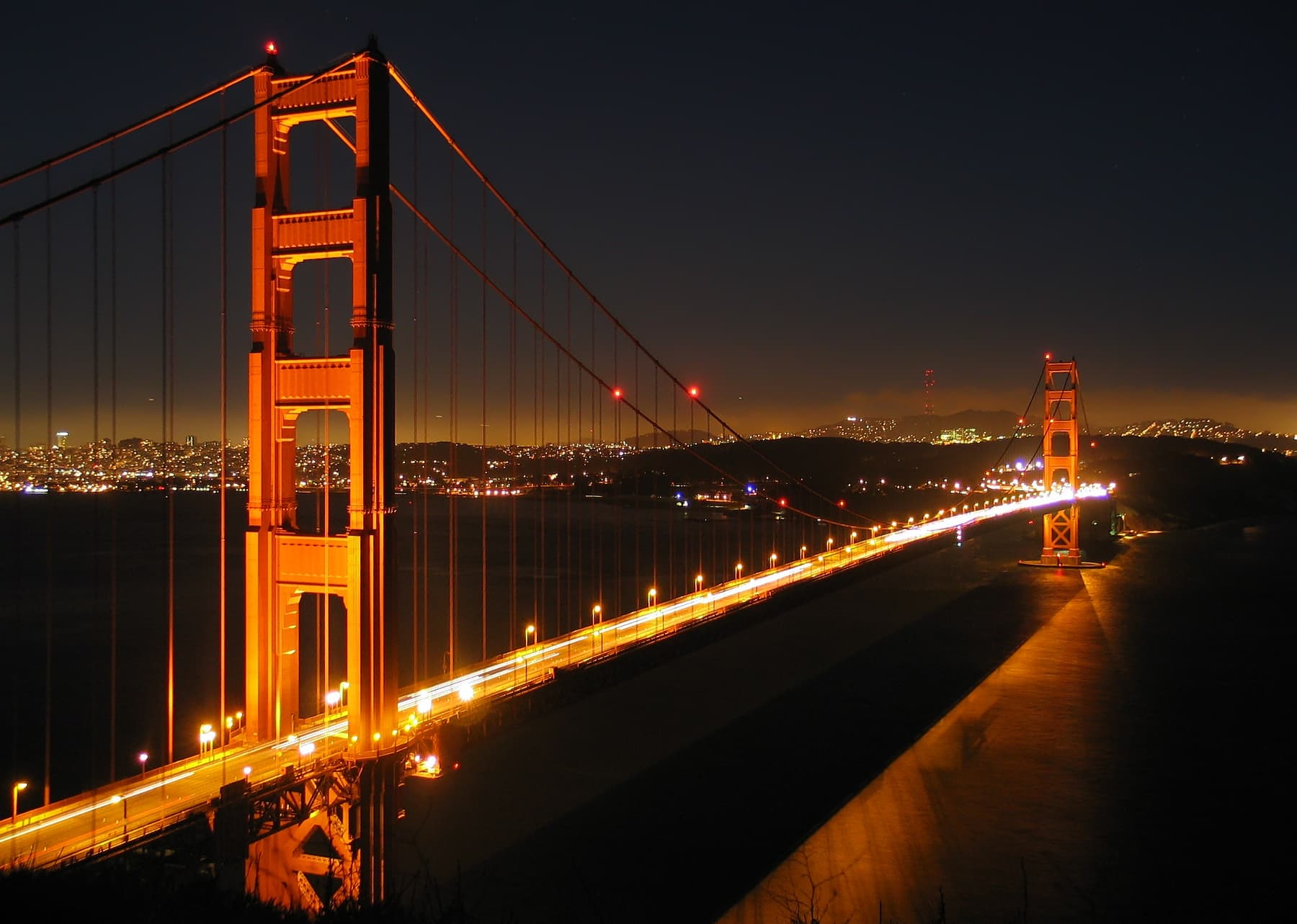
San Francisco to Monterey and Carmel, then the heart of the drive through Big Sur, on to Hearst Castle and San Simeon, Santa Barbara, and finally Los Angeles, with a night or two banked in or near Big Sur.
 Diliff / CC BY-SA 3.0 via Wikimedia Commons
Overview
The stretch of California Highway 1 from San Francisco to Los Angeles is one of the drives we would build a whole trip around: the cliffs of Big Sur dropping into the Pacific, a waterfall onto a cove beach, a hilltop castle, artichoke fields and Central Coast vineyards, and beach towns strung between. On this route the driving is the reason you came.
This is not a one-day drive. A common mistake is trying to blitz San Francisco to LA in a day and spending it white-knuckling cliffside curves in fog. Give it four to six days and sleep near Big Sur. Drive southbound for the ocean-side views.
Best for
Couples · Road-trip lovers · Photographers · Nature and scenery · Slow travel
Daily itinerary
4 to 6 days
Unlike a city break, this is a linear route where the road is the attraction. Big Sur in the middle is genuinely remote, with scarce fuel, cell service and lodging, and it is subject to real landslide and fire closures, so you plan this middle section around a road bulletin rather than around opening hours.
Best time to visit
September and October are the months we would pick to drive Highway 1. Fog thins out and the days stay warm, with lighter crowds than summer. Summer brings peak fog and peak traffic; winter carries the highest risk of storm-driven landslide closures through Big Sur.
- April to May: Green hills and wildflowers; morning and evening fog with unpredictable onset.
- June to August: Peak fog (locally "Fogust") that often burns off only by afternoon; busiest and priciest.
- September to October: Our pick of the year for weather: the summer fog has gone, the winter storms have not arrived, and the Central Coast harvest is under way. It is also the peak of fire season, which 2026 made plain. The Timber Fire started on 8 August and had burned about 25,400 acres by mid-September; the Plaskett Fire started on 26 August and reached roughly 29,800. California State Parks attributes the Big Sur park closures to them directly. On the road the picture moved week to week and the two authorities did not always agree, which is why the only road state this guide quotes is the Caltrans bulletin itself.
- November: Morning fog returns; quieter and cooler as the storm season begins.
- December to March: Storm-watching drama but the highest landslide-closure risk on the Big Sur segment.
Things worth knowing
- Central Coast wine harvest (roughly August to October) in the San Luis Obispo and Santa Ynez valleys.
- Gray whale migration is visible from coastal overlooks in winter and early spring.
Where to stay
 José Oliveira · Pexels
Monterey and Carmel-by-the-Sea
A working aquarium city paired with a one-square-mile village of art galleries and cottages. Together they anchor the northern end of the drive, with 17-Mile Drive and Point Lobos on the doorstep and easy seafood and tasting rooms.
Best for: Couples · First-timers · Galleries and seafood
Carmel is expensive and can feel twee in peak season; parking is tight.
 Riccardo Bertolo · Pexels
Big Sur
A 90-mile stretch of the Santa Lucia Mountains meeting the Pacific, reachable only by Highway 1: McWay Falls, redwood canyons and the Ventana Wilderness. This is the section to slow down for.
Best for: Couples · Hikers · Photographers · Unplugging
Lodging is scarce and very expensive and must be booked months ahead; fuel and cell service are scarce, and landslide closures are a recurring risk.
 Unknown authorUnknown author or not provided · Public domain via Wikimedia Commons
San Simeon, Cambria and San Luis Obispo
Where the drive mellows: Hearst Castle on its hill above San Simeon, the artsy village of Cambria, and the San Luis Obispo wine country of Pinot Noir and Chardonnay a little inland. A softer pace after Big Sur’s intensity.
Best for: Families · Wine lovers · A slower day
The cliff driving does not stop here. Highway 1 stays coastal through Cambria, Cayucos and Morro Bay and only merges with US-101 at San Luis Obispo, and the flat stretch in between is worth keeping rather than cutting inland early.
 Eugene Zelenko (thanks to my friends Nickolov family for generous help and company) · CC BY-SA 4.0 via Wikimedia Commons
Santa Barbara
The Spanish Colonial "American Riviera": a walkable core of State Street, Stearns Wharf and the Funk Zone wine trail, with the Santa Ynez wine country 45 minutes inland. A resort-town finale before Los Angeles.
Best for: Couples · Beach and wine · A city finish
Peak summer brings heavy crowds and traffic on Highway 101, and hotel rates spike.
 Tom Briskey · Pexels
Santa Cruz and Half Moon Bay (northern warm-up)
The 50-mile coastal stretch just south of San Francisco: state beaches, the 1872 Pigeon Point Lighthouse, and the Dungeness crab of Pillar Point Harbor. An optional less-committed lead-in before the "real" Big Sur drive.
Best for: A gentle start · Beaches · Seafood
This is a separate half-day-plus leg that duplicates some of the cliff-and-lighthouse scenery you meet again farther south.
Where to sleep
Post Ranch Inn
luxury · Big Sur
Best for: Couples · A splurge · Cliff-top seclusion
- Cliff-top rooms on a 98-acre private preserve
- Rates include breakfast and valet
- If you are going to spend once on this trip, we would spend it here
- Ultra-luxury pricing, often well over 2,000 dollars a night
- Remote, with no walkable town nearby
- Adults-only, so not for families
Alila Ventana Big Sur
resort · Big Sur
Best for: Couples · Spa · Forest-and-sea setting
- A 160-acre forest and sea setting with two pools and Japanese hot baths
- All-suite adults-oriented calm
- A glamping option alongside the suites
- Very high price point
- Limited to two guests per room, so less flexible for families
- Remote from any town
La Playa Hotel
boutique · Carmel-by-the-Sea
Best for: Couples · A walkable base · Carmel village
- A historic property recently renovated
- Steps from Carmel Beach and the village
- Gardens and an easy in-town location
- Mid-to-high pricing for what is a boutique inn rather than a resort
- No dramatic cliff setting
- Books up in peak season
El Encanto
luxury · Santa Barbara
Best for: Couples · Ocean and city views · A Santa Barbara finale
- A hillside property in Santa Barbara’s Riviera district, above the city and the sea
- Ocean and city views from the gardens and the terrace
- Polished service and a strong restaurant
- Luxury pricing
- Hillside location means a drive or shuttle into downtown
- Not walk-to-the-beach
- It is no longer a Belmond hotel: the Belmond page for it now returns a 404 and the property trades on its own site as El Encanto, so anything you saved under the old name points nowhere
Silver Surf Motel
value · San Simeon
Best for: Budget travelers · A Hearst Castle base · Families
- Affordable and minutes from Hearst Castle
- Right on Highway 1 between Big Sur and Cambria
- A practical mid-route stop
- Basic motel amenities with no resort features
- Nothing special about the setting
- San Simeon itself is very quiet
Essential experiences
 Dawn Ellner from California, USA · CC BY 2.0 via Wikimedia Commons
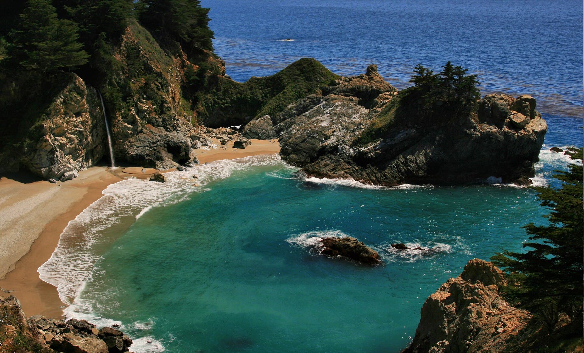
McWay Falls, Julia Pfeiffer Burns State Park
An 80-foot waterfall that drops straight onto a cove beach rather than into a pool, which is why it draws the crowd it does. Viewed from a small highway-side pullout; there is no way down to the sand. The park was partially open on 19 September 2026: day use areas, restrooms and the Partington Cove trail open, every backcountry trail east of Highway 1 closed for fire suppression and repair, and State Parks still warning of active fire in the area. Day use is 10 dollars a vehicle.
 Diliff · CC BY-SA 3.0 via Wikimedia Commons
Bixby Creek Bridge
A 1932 concrete arch bridge, 714 feet long and 280 feet above the creek, with pullouts at each end. Worth knowing before you drive to it: Rocky Creek Bridge is immediately north, and Caltrans has run a one-way signal there around the clock since the construction started, so you will sit at it in both directions.
 Raymond Zhao · Pexels
Hearst Castle
William Randolph Hearst’s hilltop estate above San Simeon, designed by Julia Morgan; visited by guided tour with reservations, and closed on major holidays.
 Spencer Davis · Pexels
17-Mile Drive
A private, gated scenic loop through Pebble Beach past the Lone Cypress and the golf links; a per-vehicle fee applies and is refundable with a qualifying restaurant purchase.
 Umay Isik · Pexels
Point Lobos State Natural Reserve
Headlands, coves and more than five miles of trails just south of Carmel, with sea lions, seals and, in winter, migrating whales.
 James Lee · Pexels
Old Mission Santa Barbara
The 1786 "Queen of the Missions," an active parish still open for self-guided and docent tours, with a landmark twin-towered facade.
 KEHN HERMANO · Pexels
Nepenthe
A Big Sur cliffside restaurant open since 1949, with a terrace over the south coast.
Piedras Blancas Elephant Seal Rookery
Free roadside viewing of northern elephant seals in San Simeon, 4.5 miles north of the Hearst Castle entrance on Highway 1, with Friends of the Elephant Seal docents on the rail most days. No fee, no reservation and almost no walking, which makes it the best value stop on the drive. Numbers peak three times a year: late January when most of the pups have been born, around the first of May for the juvenile and adult female molt, and late October for the autumn haul-out. There are seals on the sand outside those peaks too.
 King of Hearts / CC BY-SA 3.0 via Wikimedia Commons
 Brocken Inaglory / CC BY-SA 3.0 via Wikimedia Commons
Food & drink
 David McElwee · Pexels
Monterey Bay seafood
Local oysters, halibut and rockfish along the Monterey and Carmel coast.
 Doğu Tuncer · Pexels
Castroville artichokes
The town near Monterey grows a huge share of the country’s artichokes; look for them fried or grilled at roadside stands.
 Brett Sayles · Pexels
Central Coast Pinot Noir and Chardonnay
The fog and wind of the Sta. Rita Hills and San Luis Obispo make slow-ripening, high-acid wines.
 Jon Sullivan · Public domain via Wikimedia Commons
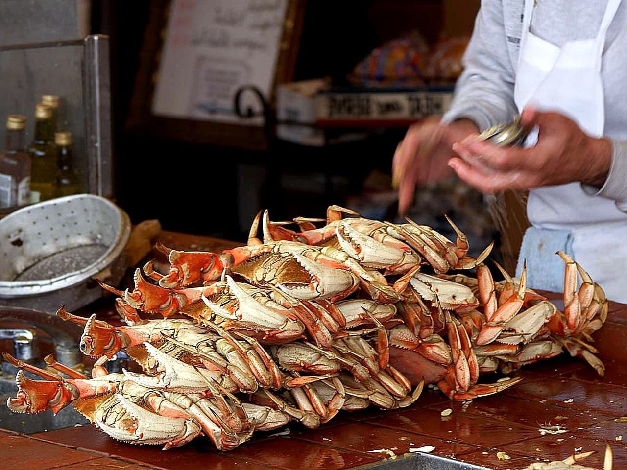
Dungeness crab
In season from roughly mid-November, though the central California commercial opening is regularly pushed back to protect migrating whales, so a late-November trip is not a guarantee; classic at the harbor towns like Half Moon Bay.
 Klaus Nahr · CC BY-SA 2.0 via Wikimedia Commons
Danish pastries in Solvang
The Danish-heritage village inland from Santa Barbara has several bakeries within a few blocks.
In Big Sur, restaurants are few and far between and many close early; plan meals around the handful of cliffside spots rather than assuming you can find food along the way.
Where to eat
Nepenthe
institutionOpen since 24 April 1949 on a cliff over the south coast; California and Mediterranean plates, best timed for the terrace. Lunch 11:30 to 16:30 and dinner 17:00 to 22:00 daily, with Cafe Kevah below it from 09:00. Its own site is phoenixshopbigsur.com, the family’s combined page, which also carries its road and fire notices; nepenthe.com and nepenthebigsur.com both redirect there. Expect a wait midday.
Last researched 2026-07-15
The Lark
modernIn a former fish market in the Funk Zone, with a Santa Barbara County-forward wine list and seasonal small plates. Book ahead.
Last researched 2026-07-15
Flaherty’s Seafood Grill & Oyster Bar
casualA long-running Carmel seafood spot for oysters and local fish, a reliable stop before heading south into Big Sur.
Last researched 2026-07-15
Sunrises
 Amanda S · Pexels
Andrew Molera State Park (Bluff Trail)
Coastal bluffs that take the first hour of light, with far fewer people than the sunset spots. Read the name honestly though: the gate opens at 8 a.m., and in the September and October window this guide recommends the sun is up between about 07:00 in early September and 07:20 in late October, so this is early light rather than sunrise itself.
Year-round
 Brennan · Pexels
Garrapata State Park bluffs
Moody, often foggy morning overlooks just north of Big Sur, good for atmospheric first light without the crowds.
Year-round
Sunsets
 Gregory Ford Henderson · CC BY-SA 4.0 via Wikimedia Commons
Nepenthe terrace
A cliff-edge terrace facing the open Pacific, best paired with an early dinner.
Year-round
 BLM Oregon & Washington · Public domain via Wikimedia Commons
McWay Falls overlook
The southwest-facing cove takes on the warmest light late in the day; small and popular, so it gets crowded at sunset.
Year-round · View only from the highway-side pullout; there is no beach access and parking is limited. · Golden light warms the cliffs; a sunrise visit avoids the crowds.
 Gordito1869 · CC BY 3.0 via Wikimedia Commons
Pfeiffer Beach
A Big Sur beach with a rock arch that catches beams of late light; the sand has a purple tint from mineral deposits.
Year-round · Reached by Sycamore Canyon Road, a narrow unmarked turn off Highway 1; there is a day-use fee and the small lot fills early. One thing to check that the state park pages will not tell you: this beach is Forest Service land, not State Parks, and the Monterey Ranger District has been under a fire emergency closure order since 29 August 2026. We could not confirm on 20 September whether the beach itself falls inside that order, because the Forest Service alerts page refused us twice, and a refused page is unknown rather than open. Check fs.usda.gov/r05/lospadres/alerts before you plan a sunset around it and keep the lodge terrace as the fallback.
Day trips
 Mo Eid · Pexels
Pinnacles National Park
An inland detour to the eroded remains of an ancient volcano: talus caves, condor habitat and rock-climbing routes, moved north over millions of years by the San Andreas Fault.
About 1.5 hours inland from the Monterey area · Full day
 Yao William · Pexels
Solvang and the Santa Ynez Valley
A Danish-heritage village inland from Santa Barbara, with bakeries, windmills and dozens of tasting rooms in the surrounding wine country.
About 45 minutes from Santa Barbara · Half to full day
 Marcus Turnbo · Pexels
Channel Islands National Park
A boat trip from Ventura, south of Santa Barbara, to the wild islands of Anacapa and Santa Cruz: sea caves, hiking and kayaking with free park admission.
About 1 hour by ferry from Ventura · Full day
After dark
 Nancy Swanstrom-Moore · Pexels
Cliffside dinner at sunset in Big Sur
foodTime a table at Nepenthe or another cliff-edge spot for the sunset over the Pacific, then a dark, star-filled drive back to your lodge.
 Tim Mossholder · Pexels
Funk Zone wine walk in Santa Barbara
wineStroll the tasting rooms of the Funk Zone near the waterfront on your last evening before Los Angeles.
Daily itinerary
Five days on Highway 1: San Francisco to Los Angeles
San Francisco to Monterey and Carmel, two nights in or near Big Sur, then Hearst Castle, Santa Barbara and Los Angeles. Southbound for the ocean-side views.
- 1
San Francisco to Monterey and Carmel
relaxedLeave San Francisco by mid-morning; drive south, optionally along the coast past Half Moon Bay.Seafood lunch in Monterey or Carmel.Point Lobos and the galleries of Carmel-by-the-Sea.Carmel Beach.Dinner in Carmel.An early night before the Big Sur drive.About 2 hours 15 on US-101, or four hours plus stops if you take Highway 1 past Half Moon Bay. Pick one before you leave: the coastal version is a half-day leg in its own right and pushes Point Lobos, whose last entry is 18:30, to the edge. Fill the tank in Carmel before heading south.Estimate: Add the 17-Mile Drive through Pebble Beach in the afternoon.
- 2
Into Big Sur
moderateDrive south over Bixby Creek Bridge; stop at the pullouts and viewpoints.A cliffside lunch at Nepenthe.McWay Falls from the Julia Pfeiffer Burns pullout, then the Partington Cove trail. Not the redwood walk at Pfeiffer Big Sur: California State Parks still listed that park closed until further notice after the Timber Fire when we checked on 19 September 2026.Your lodge terrace, or Pfeiffer Beach if the Forest Service closure order has lifted by the time you travel.Dinner near your Big Sur base.Stars over the coast, with no city glow.Short distances but slow, winding road; fuel and signal are scarce, so download offline maps.Estimate: Swap Pfeiffer Beach for the Garrapata bluffs.
- 3
Big Sur day
relaxedA morning hike or a slow start at your lodge.Lunch in the Big Sur valley.More coast: Andrew Molera or a return to a favorite overlook.A second Big Sur sunset from a cliff terrace.Dinner in Big Sur.A quiet night before moving on.Local driving only; keep an eye on any one-way controlled sections.Estimate: If closures affect the route, use this day as a buffer.
- 4
Hearst Castle to Santa Barbara
fullDrive south to Hearst Castle for a reserved tour above San Simeon.Lunch in Cambria or San Luis Obispo.Continue to Santa Barbara as Highway 1 joins Highway 101.Stearns Wharf or the Santa Barbara waterfront.Dinner in the Funk Zone.A Funk Zone wine walk.About three hours San Simeon to Santa Barbara, more if Santa Maria or Gaviota is slow. Take the earliest Hearst Castle tour you can get, usually from 09:00, be at the Visitor Center twenty minutes before it and allow about two and a half hours on site with the shuttle. On those numbers you are in Santa Barbara by mid-afternoon even with lunch, which leaves the waterfront sunset comfortable rather than tight. It is the Hearst Castle slot that sets the day: a later tour is what turns this into a rush.Estimate: Skip Hearst Castle for a beach morning if palaces are not your thing.
- 5
Santa Barbara to Los Angeles
moderateThe Old Mission and State Street, or a last beach walk.Lunch in Santa Barbara or an optional Solvang detour.Drive to Los Angeles.Arrive in LA.Dinner in Los Angeles.Return the car or continue your trip.About 1.5 to 2 hours Santa Barbara to Los Angeles under normal traffic.Estimate: Add the Solvang and Santa Ynez wine country if you have the time.
Getting around
- Most travelers start from San Francisco International Airport (SFO) and end at Los Angeles International Airport (LAX), picking up a rental car for the one-way drive.
- One-way car rentals between the Bay Area and Los Angeles are widely available but carry a drop-off fee. US rental desks generally want a credit card in the driver’s name for the deposit, the major chains rent from 21, and drivers aged 21 to 24 pay a young-driver surcharge, so check both before you count on a debit card.
- From Tel Aviv the two ends of this route are not equivalent. The Israel Airports Authority flight board carries no San Francisco rows at all and nine Los Angeles rows, operated by El Al as LY 005 and 106 with Delta and Aeromexico numbers sitting on the same times, so LAX is the nonstop end and SFO is a connection. That is an argument for the southbound direction this guide already recommends: you connect on the way out, when the flight is a means to an end, and fly home nonstop from the city you finish in.
- Israeli citizens with a biometric passport travel to the United States under the Visa Waiver Program and need an ESTA approved before departure rather than a visa. The fee is USD 40.27, raised from USD 21 under the One Big Beautiful Bill Act and now adjusted for inflation every year, which the Department of Homeland Security did for fiscal 2026 in a Federal Register notice on 19 November 2025. Apply only at esta.cbp.dhs.gov: the Israeli Foreign Ministry publishes a specific warning to use the official site and beware of unofficial ones, and CBP’s own FAQ carries the question “I’ve been charged more than US $40.27 for ESTA, why?”, which tells you how common the overcharging is.
- A rental car is essential; there is no practical public transport substitute for this route.
- The road itself, as of the Caltrans bulletin timestamped 19 September 2026: Caltrans lists no closure anywhere between Carmel and San Simeon, and the only restriction on the Big Sur stretch is one-way controlled traffic at the Rocky Creek Bridge, 15.7 miles south of Monterey, running 24 hours a day seven days a week for construction until 06:00 on 30 November 2026. Expect to wait at a signal there, not a detour. This was the state on the day we reviewed this guide, 20 September 2026, and it is exactly the kind of fact that goes stale, so read the Caltrans page yourself before you drive.
- Drive southbound so you sit on the ocean side of the two-lane road for the best, safest pullouts.
- Download offline maps: cell service is spotty to nonexistent through most of Big Sur.
Things worth knowing
- · Trying to drive San Francisco to Los Angeles on Highway 1 in a single day.
- · Not booking Big Sur lodging months ahead; supply is tiny and fills first.
- · Passing the Carmel or San Simeon pumps on the theory that you will find fuel in Big Sur. There are a handful of stations along the stretch, but they are far apart, keep short hours and charge a large premium; start the Big Sur section with a full tank.
- · Driving in peak fog months expecting clear ocean views, or starting so late that curves are driven after dark.
- · Setting out without reading the Caltrans bulletin that morning. This road closes for landslides and, in 2026, for fire; a guide written two months ago cannot tell you whether it is open today, and Caltrans can, at roads.dot.ca.gov.
Budget
| Low | Expected | Comfortable | |
|---|---|---|---|
| Accommodation style / per night | $90 | $300 | $900 |
| Food style / per day | $45 | $110 | $260 |
| Local transport / per day | $50 | $85 | $130 |
| Estimate / per day | $15 | $45 | $120 |
Estimate · USD · 2026-07-15. Accommodation is per room per night (two sharing); Big Sur lodging runs far higher than the town options. Local transport is a shared rental car plus fuel, which is priced well above city rates inside Big Sur. The accommodation, food and attraction bands were priced in July 2026 and have not been re-priced. Fuel was re-checked on 20 September 2026 and had moved enough to raise the transport band: AAA put the California average for regular at 6.08 dollars a gallon against about 5.44 when this was first priced, with San Francisco at 6.23, and Big Sur pumps sit well above the state figure.
Things worth knowing
Frequently asked questions
How many days do you need to drive Highway 1 from San Francisco to LA?
Four to six days. Four is a compressed version with one Big Sur night; five or six lets you bank two nights near Big Sur and add Hearst Castle, Santa Barbara and a detour like Solvang without rushing.
Which direction should you drive Highway 1?
Southbound, from San Francisco to Los Angeles. That puts you in the ocean-side lane, so pulling over at a viewpoint means a right turn rather than a crossing.
When is the best time to drive the California coast?
September and October, when the fog is at its thinnest and the days are warm, with lighter crowds than summer. Winter has the highest risk of landslide closures through Big Sur.
Do you need to book Big Sur hotels in advance?
Yes. Big Sur has very few rooms and they sell out months ahead, especially in the shoulder and summer seasons; it is the part of the trip to lock in first.
Is Highway 1 through Big Sur open?
On 19 September 2026 Caltrans listed no closure between Carmel and San Simeon and one restriction: one-way controlled traffic at the Rocky Creek Bridge, 15.7 miles south of Monterey, around the clock for construction until 06:00 on 30 November 2026. That means a wait at a signal, not a detour. But this is the one fact in the guide most likely to be wrong by the time you read it. The road closed during the 2026 fire season as well as for landslides, so read the Caltrans bulletin at roads.dot.ca.gov the morning you drive, not the week before.
Can I fly direct from Tel Aviv, and which end should I start at?
Only to the Los Angeles end. The Israel Airports Authority board carries no San Francisco service at all and nine Los Angeles rows, flown by El Al as LY 005 and 106. That fits the southbound direction anyway: connect on the way out to San Francisco, drive the coast with the ocean on your right, and take the nonstop home from LAX. Israelis with a biometric passport need an ESTA, USD 40.27, approved before departure, California accepts a valid foreign licence from a visitor and does not require an international driving permit, but individual rental companies set their own policy and some ask for one, so it is cheap insurance against an argument at the counter.
Sources (10)
- Highway 1 conditions and Big Sur travel information · tourism-board · 2026-07-15
- Julia Pfeiffer Burns State Park and McWay Falls · national-park · 2026-07-15
- Hearst Castle tours and information · museum · 2026-07-15
- California road trip and Central Coast overview · tourism-board · 2026-07-15
- Caltrans road information timestamped Saturday 19 September 2026 at 23:10 reports for SR 1 in the Central California area one-way controlled traffic 15.7 miles south of Monterey at Rocky Creek Bridge, Monterey County, 24 hours a day seven days a week through 06:00 on 30 November 2026 due to construction, and lists no other restriction on the Big Sur stretch · transport-operator · 2026-09-20
- The Israeli National Security Council rates the United States level 1 with no travel warning, with the wording: escalation in displays of hostility toward Israelis and Jews, harassment, threats, incitement, vandalism and at times physical assault, recommending precautions; the Foreign Ministry records state that Israeli citizens with a biometric passport are exempt from a visitor visa but must obtain online entry authorisation in advance, and separately warn to submit the application only on the official site · government · 2026-09-20
- A query of the Israel Airports Authority flight board for SFO returns zero rows; the same board queried for LAX returns nine, operated by El Al as LY 005 and LY 106 with Delta and Aeromexico numbers on identical times. The URL below is the SFO query; swap SFO for LAX in it to see the other half · airport · 2026-09-20
- California State Parks, page last checked 19 September 2026, states that Pfeiffer Big Sur State Park is closed until further notice due to the continued impacts of the Timber and Plaskett Fires; that Julia Pfeiffer Burns State Park is partially open with all backcountry trails east of Highway 1 closed and active fire remaining in the area; that Andrew Molera campgrounds reopened after 15 September with the Old Coast Road and East Molera Trail still closed; and gives the Timber Fire at approximately 25,426 acres and 39 percent contained and the Plaskett Fire at approximately 29,800 acres and 89 percent contained · national-park · 2026-09-20
- The National Park Service states that under executive order 14314 of 3 July 2025 each non-US resident aged 16 and older pays a USD 100 nonresident fee per person on top of the standard entrance fee at eleven parks, namely Acadia, Bryce Canyon, Everglades, Glacier, Grand Canyon, Grand Teton, Rocky Mountain, Sequoia and Kings Canyon, Yellowstone, Yosemite and Zion; that from 1 January 2026 the America the Beautiful annual pass is USD 80 for residents and USD 250 for nonresidents, the latter covering the vehicle or the holder plus three adults and both the entrance and nonresident fees; and that from 2026 fee-free days apply to US residents only · national-park · 2026-09-20
- The Department of Homeland Security announced fiscal year 2026 inflationary adjustments to immigration fees required by the One Big Beautiful Bill Act, including the Electronic System for Travel Authorization fee, in a Federal Register notice published 19 November 2025; CBP’s own ESTA FAQ carries the entry “I’ve been charged more than US $40.27 for ESTA, why?”, confirming USD 40.27 as the official amount · government · 2026-09-20